Skip to content

Walk, Explore and Discover

+977 9800000000

Direct call or whatsapp 24/7

Walk, Explore and Discover

+977 9851335885

Direct call or whatsapp 24/7

Nar Phu Teri La Upper Mustang Trek – 24 Days

Key Points

DestinationNepal
Duration24 Days
Max Altitude5,595 m
AccommodationHotels, basic lodges and full camping according to the route
MealsCamping and lodge meals according to the confirmed package
Best TimeLate April–May and October, subject to pass conditions
RegionAnnapurna Region

Expedition Overview

The Nar Phu Teri La Upper Mustang Trek is one of the most adventurous and remote trekking journeys in Nepal. This 24-day expedition combines three extraordinary Himalayan experiences: the hidden valleys of Nar and Phu, the challenging Teri La Pass, and the ancient landscapes of Upper Mustang.

Trip Highlights

  • Explore the remote Nar and Phu valleys
  • Experience one of Nepal's most isolated Himalayan trekking regions
  • Visit the traditional villages of Phu and Nar
  • Experience Tibetan-influenced Himalayan culture
  • Explore ancient Buddhist monasteries, chortens and mani walls
  • Trek through spectacular narrow gorges and high mountain valleys
  • Experience remote Himalayan wilderness away from the crowds
  • Cross the challenging Teri La Pass
  • Experience high-altitude camping in remote mountain terrain
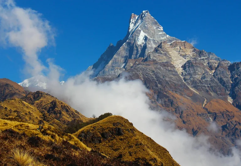
  • Enjoy spectacular views of Himlung Himal, Kang Guru, Annapurna and surrounding peaks
  • Trek through the dramatic landscapes between Manang and Mustang
  • Enter the restricted Upper Mustang region
  • Experience the unique Tibetan culture of Upper Mustang
  • Explore ancient villages and traditional stone houses
  • Visit the historic walled city of Lo Manthang
  • Explore ancient monasteries and Buddhist cultural sites

Cost Includes

  • Experienced, licensed and English-speaking trekking guide
  • Experienced high-altitude trekking guide for the Teri La section
  • Experienced porters and camping crew
  • Necessary Nar Phu restricted-area permits
  • Upper Mustang restricted-area permit
  • Annapurna Conservation Area Permit where applicable
  • Necessary conservation and government permits
  • Trekking staff salaries
  • Trekking staff accommodation, food and insurance
  • Accommodation & Food in local teahouses and guesthouses
  • Camping accommodation during remote sections
  • Camping tents and necessary camping equipment
  • Kitchen tent and dining equipment during camping
  • Experienced trekking cook and kitchen crew
  • Three meals per day during the trek
  • Breakfast, lunch and dinner
  • Necessary transportation according to the confirmed itinerary
  • Besisahar/Dharapani transportation
  • Jomsom/Pokhara transportation
  • Basic trekking first-aid kit
  • Guide and camping crew equipment
  • Porter service for trekking baggage
  • Government taxes
  • Official service charges
  • Trekking logistics and coordination
  • Emergency trekking assistance
  • Necessary camping food and kitchen logistics

Cost Excludes

  • International airfare
  • Nepal tourist visa fee
  • Travel and trekking insurance
  • Emergency helicopter evacuation
  • Emergency medical expenses
  • Personal medication
  • Personal medical treatment
  • Extra hotel accommodation in Kathmandu or Pokhara
  • Meals outside the included itinerary
  • Alcoholic beverages
  • Soft drinks and bottled drinks
  • Personal snacks
  • Personal trekking equipment
  • Sleeping bag and down jacket if not provided
  • Internet and telephone expenses
  • Charging fees where applicable
  • Laundry expenses
  • Personal shopping and expenses
  • Tips for guides, porters, cooks and trekking staff
  • Any additional accommodation caused by itinerary changes
  • Costs caused by bad weather, natural disasters, landslides, snowfall, road closures or unforeseen circumstances
  • Any cost resulting from early departure from the trek
  • Any service not specifically mentioned under "Includes."

Day-by-Day Route Itinerary

Day 1

Kathmandu to Besisahar

Duration: Approximately 6–8 hours
FromKathmandu
ToBesisahar
Start altitude1,324 m
End altitude760 m

Your adventure begins with a scenic drive from Kathmandu toward Besisahar.

The journey passes through green hills, terraced farmland, rivers, waterfalls and traditional villages.

As we leave Kathmandu behind, the landscape gradually changes from urban surroundings to the green hills of central Nepal.

Besisahar is the gateway to the Annapurna and Manang regions.

After arriving, we meet the trekking team and prepare for the journey ahead.

Overnight in Besisahar.

AccommodationHotel/Guesthouse
MealsBreakfast, Lunch and Dinner
TransportRoad transfer
Day 2

Besisahar to Dharapani

Duration: Approximately 5–6 hours
FromBesisahar
ToDharapani
Start altitude760 m
End altitude1,860 m

After breakfast, we continue toward the Manang region by road.

The journey follows the Marsyangdi River through mountain villages, waterfalls, suspension bridges and beautiful valleys.

The scenery becomes increasingly dramatic as we climb higher into the mountains.

We eventually reach Dharapani, an important settlement on the Annapurna Circuit.

Overnight in Dharapani.

AccommodationTeahouse/Guesthouse
MealsBreakfast, Lunch and Dinner
Day 3

Dharapani to Koto

Duration: Approximately 5–6 hours
FromDharapani
ToKoto
Start altitude1,860 m
End altitude2,600 m

Today we begin trekking toward Koto.

The trail follows the Marsyangdi Valley through forests and traditional mountain settlements.

As we approach Koto, the landscape becomes increasingly dramatic.

Koto is the gateway to the restricted Nar Phu Valley.

Our guide completes the necessary preparations before we enter the remote valley.

Overnight in Koto.

AccommodationTeahouse/Guesthouse
MealsBreakfast, Lunch and Dinner
Day 4

Koto to Meta

Duration: Approximately 6–7 hours
FromKoto
ToMeta
Start altitude2,600 m
End altitude3,560 m

Today we officially enter the remote Nar Phu Valley.

The trail follows the Nar Phu Khola through a spectacular narrow gorge.

We cross suspension bridges and walk through forests of pine and juniper.

As we gain altitude, the landscape changes from green forest to dry, rocky Himalayan terrain.

After several hours of trekking, we reach Meta.

The surrounding cliffs and mountains provide an impressive introduction to the remote wilderness of Nar Phu.

Overnight in Meta.

AccommodationTeahouse/Guesthouse
MealsBreakfast, Lunch and Dinner
Day 5

Meta to Kyang

Duration: Approximately 5–6 hours
FromMeta
ToKyang
Start altitude3,560 m
End altitude3,800 m

We continue deeper into the Nar Phu Valley.

The trail passes through rugged terrain with spectacular views of cliffs, mountains and high-altitude valleys.

The landscape becomes increasingly barren as we approach the higher parts of the valley.

We continue toward Kyang, an important stopping point before Phu.

Overnight in Kyang.

AccommodationTeahouse/Guesthouse
MealsBreakfast, Lunch and Dinner
Day 6

Kyang to Phu Village

Duration: Approximately 4–6 hours
FromKyang
ToPhu Village
Start altitude3,800 m
End altitude4,080 m

Today we reach the spectacular village of Phu.

The trail continues through dramatic rocky landscapes, ancient chortens and narrow mountain valleys.

Phu Village appears dramatically against the surrounding mountains.

The village is known for its traditional stone houses, Buddhist monasteries and Tibetan-influenced culture.

After arriving, we explore the village and enjoy views of the surrounding Himalayan peaks.

Overnight in Phu Village.

AccommodationTeahouse/Guesthouse
MealsBreakfast, Lunch and Dinner
Day 7

Acclimatization and Exploration in Phu

End altitude4,080 m

Acclimatization hike and exploration: approximately 3–5 hours

Today is an important acclimatization day.

We explore Phu Village and its surrounding areas while allowing our bodies to adjust to the altitude.

You can visit ancient monasteries, chortens, prayer wheels and traditional homes.

A short hike to a nearby viewpoint may be arranged depending on weather and the physical condition of the group.

This is also an excellent opportunity to experience the local lifestyle and culture.

Overnight in Phu Village.

AccommodationTeahouse/Guesthouse
MealsBreakfast, Lunch and Dinner
Day 8

Phu Village to Nar Phedi

Duration: Approximately 6–7 hours
FromPhu Village
ToNar Phedi
Start altitude4,080 m
End altitude3,490 m

We leave Phu and retrace part of the trail before turning toward Nar Phedi.

The route follows the valley and passes through rugged landscapes, river crossings and dramatic cliffs.

We gradually descend before reaching Nar Phedi.

This peaceful settlement is an important stop before the climb toward Nar Village.

Overnight in Nar Phedi.

AccommodationTeahouse/Guesthouse
MealsBreakfast, Lunch and Dinner
Day 9

Nar Phedi to Nar Village

Duration: Approximately 3–4 hours
FromNar Phedi
ToNar Village
Start altitude3,490 m
End altitude4,110 m

Today we climb toward the traditional village of Nar.

The trail passes through stone walls, mani walls, chortens and beautiful mountain scenery.

Nar is one of the most fascinating villages in the region, with traditional stone houses and centuries-old cultural traditions.

After arriving, we explore the village and prepare for the challenging Teri La section ahead.

Overnight in Nar Village.

AccommodationTeahouse/Guesthouse
MealsBreakfast, Lunch and Dinner
Day 10

Acclimatization Day in Nar

FromNar
ToNar
Start altitude4,110 m
End altitude4,110 m

Acclimatization hike and exploration: approximately 3–5 hours

Today is another important acclimatization day.

We explore Nar Village and the surrounding area.

The guide may arrange a short hike to a nearby viewpoint depending on weather and trail conditions.

This day is important because we will soon enter a remote high-altitude section where the Teri La Pass requires strong acclimatization.

We also prepare our camping equipment and supplies for the coming days.

Overnight in Nar Village.

AccommodationTeahouse/Guesthouse
MealsBreakfast, Lunch and Dinner
Day 11

Trek from Nar Village to Yak Kharka

Duration: Walking: 8–9 hours
FromNar Village
ToYak Kharka
Start altitude4,110 m
End altitude4,400 m

Leave Nar on a long wilderness stage through high pasture and increasingly isolated terrain. The support team establishes camp at the safest practical Yak Kharka site; the exact location can vary with water, grazing use and weather. Higher along the route, open valleys and rocky mountain scenery replace the lower vegetation; clear skies can reveal the dramatic Annapurna-region peaks.

Day 12

Trek from Yak Kharka to Lapse Khola

Duration: Walking: 5–6 hours
FromYak Kharka
ToLapse Khola
Start altitude4,400 m
End altitude4,500 m

Continue along the remote valley toward Lapse Khola. The distance is moderate, but altitude, rough ground and the absence of permanent settlements require controlled pacing and full camping support. Higher along the route, open valleys and rocky mountain scenery replace the lower vegetation; clear skies can reveal the dramatic Annapurna-region peaks.

Day 13

Trek from Lapse Khola to Teri La High Camp

Duration: Walking: 5–6 hours
FromLapse Khola
ToTeri La High Camp
Start altitude4,500 m
End altitude4,900 m

Follow the upper drainage to high camp below Teri La. The guide selects a protected campsite, checks the route and weather, and prepares the team for an early pass crossing. The scenery becomes more open on the higher sections, while the route’s changing slopes and exposed ground make each stage feel different from the valleys below.

Day 14

Cross Teri La to Pasphu Khola Camp

Duration: Walking: 8–10 hours
FromCross Teri La
ToPasphu Khola Camp
Highest altitude5,595 m

Start before dawn and climb over scree, snow or ice toward Teri La. Descend carefully into Upper Mustang to Pasphu Khola Camp. Crampons or other traction may be required, and the crossing proceeds only when the guide judges conditions safe. Village architecture, prayer flags and local farming traditions provide a close look at the communities living along these important mountain routes.

Day 15

Trek from Pasphu Khola Camp to Yakpa

Duration: Walking: 6–8 hours
FromPasphu Khola Camp
ToYakpa
End altitude4,300 m

Continue down the Pasphu Khola and into the broader Samena Khola valley. This remains a remote camping stage, with the final stopping point determined by water, terrain and local conditions. At higher elevations the valley feels more open and the mountains more immediate, while the route crosses exposed sections shaped by wind and weather.

Day 16

Trek from Yakpa to Tangye

Duration: Walking: 5–7 hours
FromYakpa
ToTangye
Start altitude4,300 m
End altitude3,340 m

Descend through high pasture and stream-cut country to Tangye, an isolated Upper Mustang settlement known for its long mani wall and large chortens. Lodge availability is limited, so camping remains a practical fallback. The terrain becomes more exposed, with stone paths and high slopes that emphasize the scale of the surrounding Himalayan landscape. At higher elevations the valley feels more open and the mountains more immediate, while the route crosses exposed sections shaped by wind and weather.

Day 17

Trek from Tangye to Yara

Duration: Walking: 6–7 hours
FromTangye
ToYara
Start altitude3,340 m
End altitude3,650 m

Cross a succession of ridges and eroded valleys on the rarely used trail to Yara. The day includes repeated ascents and descents despite the modest difference between the two sleeping elevations. Higher along the route, open valleys and rocky mountain scenery replace the lower vegetation; clear skies can reveal the dramatic Annapurna-region peaks. The terrain becomes more exposed, with stone paths and high slopes that emphasize the scale of the surrounding Himalayan landscape.

Day 18

Trek from Yara to Lo Manthang

Duration: Walking: 7–8 hours
FromYara
ToLo Manthang
Start altitude3,650 m
End altitude3,840 m

Climb out of Yara and cross the Dhi La and Lo La area before descending toward the walled city of Lo Manthang. This is a long cultural and scenic stage after the wilderness crossing. Lo Manthang’s walled settlement and monastery traditions offer a closer look at the distinctive history and culture of Upper Mustang. Higher along the route, open valleys and rocky mountain scenery replace the lower vegetation; clear skies can reveal the dramatic Annapurna-region peaks.

Day 19

Explore Lo Manthang and the Chhoser Valley

Duration: Excursion: 4–6 hours
End altitude3,840 m

dinner Spend the day exploring Lo Manthang and, when local access and conditions allow, travel into the Chhoser Valley to visit monasteries and cave sites. Entry and photography depend on local permission. Lo Manthang’s walled settlement and monastery traditions offer a closer look at the distinctive history and culture of Upper Mustang. Higher along the route, open valleys and rocky mountain scenery replace the lower vegetation; clear skies can reveal the dramatic Annapurna-region peaks.

AccommodationTeahouse | Meals: Breakfast, lunch and
Day 20

Trek from Lo Manthang to Dhakmar

Duration: Walking: 6–7 hours
FromLo Manthang
ToDhakmar
Start altitude3,770 m
End altitude3,810 m

Leave Lo Manthang by the western return route, crossing high, wind-exposed terrain toward Dhakmar. Red cliffs, chortens and long views across the Mustang plateau define the stage. Lo Manthang’s walled settlement and monastery traditions offer a closer look at the distinctive history and culture of Upper Mustang. Higher along the route, open valleys and rocky mountain scenery replace the lower vegetation; clear skies can reveal the dramatic Annapurna-region peaks.

Day 21

Trek from Dhakmar to Ghiling

Duration: Walking: 5–6 hours
FromDhakmar
ToGhiling
Start altitude3,810 m
End altitude3,570 m

Continue south through ridges, dry valleys and cultivated pockets toward Ghiling. The route avoids unnecessary backtracking to Muktinath and maintains a continuous descent through Upper Mustang. The terrain becomes more exposed, with stone paths and high slopes that emphasize the scale of the surrounding Himalayan landscape. At higher elevations the valley feels more open and the mountains more immediate, while the route crosses exposed sections shaped by wind and weather.

Day 22

Trek from Ghiling to Chhusang

Duration: Walking: 6–7 hours
FromGhiling
ToChhusang
Start altitude3,570 m
End altitude3,050 m

Descend through Samar and Chele toward Chhusang in the Kali Gandaki corridor. Expect wind, loose trail surfaces and warmer conditions as elevation decreases. Green hillsides, local homes and changing valley views make this approach distinctive before the landscape rises into more exposed mountain terrain. Village architecture, prayer flags and local farming traditions provide a close look at the communities living along these important mountain routes.

Day 23

Drive from Chhusang to Jomsom

Duration: Driving: 2–4 hours
FromChhusang
ToJomsom
Start altitude3,050 m
End altitude2,720 m

Travel by 4WD through Kagbeni to Jomsom, creating a realistic buffer before the onward journey to Pokhara. If road conditions permit and the group prefers to walk, part of the route may be completed on foot. Green hillsides, local homes and changing valley views make this approach distinctive before the landscape rises into more exposed mountain terrain. Along the road, changing settlements and valley views reveal how the landscape shifts between the departure point and the next overnight stop.

TransportRoad transfer
Day 24

Fly or Drive from Jomsom to Pokhara

Duration: Flight: about 20–25 minutes
FromJomsom
ToPokhara
Start altitude2,720 m
End altitude800 m

Take an early weather-dependent flight to Pokhara or use the road alternative if aviation is disrupted. Keep a flexible onward schedule because mountain flights and roads can both be delayed. Along the road, changing settlements and valley views reveal how the landscape shifts between the departure point and the next overnight stop. During the flight toward Pokhara, clear weather may reveal the green valleys and distant Annapurna-region mountains; the lakeside city sits below the surrounding hills.

TransportFlight or road transfer

Essential Packing lists

Main Trekking Gear5
Daypack / Backpack (30–40L)Comfortable daypack with rain cover for water, layers, camera and daily essentials.
Duffel Bag (60–80L)For porter or luggage transport on multi-day trips where applicable.
Warm Sleeping BagTemperature rating should match the season and maximum sleeping altitude.
Trekking PolesUseful for long descents, uneven trails and reducing knee strain.
Water Bottles / Hydration System (2L+)Carry enough refillable capacity for the day.
Clothing – Layering System7
Moisture-Wicking Base LayersQuick-dry tops and bottoms; avoid cotton for cold/high-altitude trekking.
Fleece / Mid LayerWarm breathable layer for mornings, evenings and cooler trail sections.
Insulated Down / Synthetic JacketWarm outer insulation suitable for the season and altitude.
Waterproof / Windproof ShellLightweight hooded jacket for rain, snow and strong wind.
Trekking Pants / Hiking TrousersComfortable quick-dry trousers plus a warmer option for colder trips.
Thermal BottomsUseful for cold evenings, high camps and winter trips.
Trekking SocksSeveral pairs of moisture-wicking trekking socks plus warm socks.
Headwear & Handwear4
Sun Hat / CapFor strong daytime sun and UV exposure.
Warm BeanieWarm hat covering the ears for cold mornings and evenings.
Buff / Neck GaiterMulti-purpose protection from sun, dust, wind and cold.
Warm GlovesInsulated gloves; add waterproof outer gloves for winter/high altitude.
Footwear3
Trekking Boots (1 pair)Mostly waterproof and broken-in boots with ankle support.
Camp Shoes / Sandals (1 pair)Light footwear for lodges, camps and rest time.
GaitersRecommended for snow, mud, loose scree and winter conditions.
Toiletries & Hygiene5
Sunscreen SPF 50+High UV protection is important at altitude.
Lip Balm with SPFProtects lips from wind, cold and strong UV.
Hand Sanitizer / Biodegradable SoapCompact personal hygiene supplies.
Personal ToiletriesToothbrush, toothpaste and small personal hygiene items.
Toilet Paper / Wet WipesCarry a small personal supply and dispose responsibly.
Health & First Aid4
Personal MedicinesBring enough prescription medicine for the full trip plus reserve days.
Small Personal First-Aid KitBasic pain relief, bandages, antiseptic and common personal medicines.
Blister CareMoleskin, blister pads or similar foot-care supplies.
Water PurificationPurification tablets, drops or a reliable filter where needed.
Documents & Money4
Passport & VisaOriginal passport plus required visa documentation.
Travel Insurance DetailsCarry policy and emergency contact details; high-altitude cover when relevant.
Permit / ID CopiesKeep digital and paper copies of important travel documents.
Cash & Bank CardsRemote areas may have limited or unreliable ATM/card access.
Electronics & Accessories3
Headlamp + Spare BatteriesEssential for early starts, lodges and power cuts.
Power BankCharging can be limited or paid at remote lodges.
Phone / CameraProtect electronics from dust, rain and cold.
Optional but Recommended Items3
UV-Protected SunglassesStrong UV protection; glacier-rated lenses for snowy/high-altitude routes.
Personal Snacks / Energy BarsUseful for long walking days between meals.
Dry Bags / Zip BagsKeep electronics, documents and spare clothes dry and organized.
Essentials13
This is a demanding high-altitude trek combining remote camping and restricted-area trekking. Proper equipment is essential
Moisture-wicking trekking T-shirts
Long-sleeve trekking shirts
Thermal leggings
Warm underwear
Extra socks
Waterproof gloves
Trekking Equipment
Camp shoes or sandals
Backpack rain cover
Spare batteries
Water bottles
Waterproof packing bags

What Makes This Trip Different?

Box 1: Authentic Culture and Local Experience

Link the living Tibetan-influenced cultures of Phu, Nar and Upper Mustang through villages, monasteries and remote seasonal landscapes.

Box 2: Nature, Adventure and Responsible Travel

Cross the isolated Teri La with full camping support, careful acclimatization and strict environmental practices.

Accommodation Details

dinner

Spend the day exploring Lo Manthang and, when local access and conditions allow, travel into the Chhoser Valley to visit monasteries and cave sites. Entry and photography depend on local permission.

Day 20: Trek from Lo Manthang to Dhakmar

Sleep elevation: approximately 3,810 m / 12,500 ft | Walking: 6–7 hours | Accommodation & Food: Teahouse | Meals: Breakfast, lunch and dinner

Leave Lo Manthang by the western return route, crossing high, wind-exposed terrain toward Dhakmar. Red cliffs, chortens and long views across the Mustang plateau define the stage.

Day 21: Trek from Dhakmar to Ghiling

Sleep elevation: approximately 3,570 m / 11,713 ft | Walking: 5–6 hours | Accommodation & Food: Teahouse | Meals: Breakfast, lunch and dinner

Continue south through ridges, dry valleys and cultivated pockets toward Ghiling. The route avoids unnecessary backtracking to Muktinath and maintains a continuous descent through Upper Mustang.

Day 22: Trek from Ghiling to Chhusang

Sleep elevation: approximately 3,050 m / 10,006 ft | Walking: 6–7 hours | Accommodation & Food: Teahouse | Meals: Breakfast, lunch and dinner

Descend through Samar and Chele toward Chhusang in the Kali Gandaki corridor. Expect wind, loose trail surfaces and warmer conditions as elevation decreases.

Day 23: Drive from Chhusang to Jomsom

Sleep elevation: approximately 2,720 m / 8,924 ft | Driving: 2–4 hours | Accommodation & Food: Teahouse or hotel | Meals: Breakfast, lunch and dinner

Travel by 4WD through Kagbeni to Jomsom, creating a realistic buffer before the onward journey to Pokhara. If road conditions permit and the group prefers to walk, part of the route may be completed on foot.

Day 24: Fly or Drive from Jomsom to Pokhara

Pokhara elevation: approximately 822 m / 2,697 ft | Flight: about 20–25 minutes; road alternative: 8–10 hours | Accommodation & Food: Not included unless stated | Meals: Breakfast

Safety, Insurance and Emergency Information

Comprehensive travel insurance is essential for this trek.

Your policy should specifically cover:

High-altitude trekking

Trekking above 5,000 meters

Emergency medical treatment

Helicopter evacuation

Search and rescue

Trip cancellation

Trip interruption

Check the maximum altitude covered by your insurance before departure.

Emergency and Evacuation

This is a remote trekking expedition.

Emergency evacuation can be difficult and may depend on weather, location and helicopter availability.

Our team will coordinate appropriate emergency procedures when required.

However, trekkers must understand that rescue from remote high-altitude areas can take time.

Best Season, Weather and Temperature

Weather in the high Himalayas can change rapidly.

Snow, strong winds, rain, freezing temperatures, rockfall and difficult trail conditions can affect the itinerary.

The Teri La crossing is particularly dependent on current weather and snow conditions.

Our guides will monitor conditions and make safety decisions based on the actual situation.

Your safety always comes before the planned itinerary.

Food and Water

During the teahouse sections, meals are prepared by local lodges.

During the camping sections, our trekking cook prepares meals for the group.

Meals generally include nutritious carbohydrates, vegetables, rice, pasta, noodles, soups and other suitable trekking foods.

Because the trek is long and physically demanding, carrying additional energy snacks is recommended.

Always carry sufficient drinking water and a reliable water purification system.

US$ 4,000 PP
Group range:US$ 4,000 - US$ 5,500
Duration:24 Days

Group-Size Discounts

Pricing is based on your group size. We do not add others to your group.

No. of PersonsGroup TypePrice per Person
1 Pax Private Trip US$ 5,500 Book
2-6 Pax Small Group US$ 4,500 Book
7-9 Pax Best Value US$ 4,200 Book
Super Group US$ 4,000 Book
Dates & discounts are applied in the next step.

Guides and Porters

A licensed local guide leads the journey, manages pace and logistics, monitors weather and guest wellbeing, and coordinates accommodation, permits and transport. Porters, cooks or additional field staff are assigned according to the route, group size and confirmed package.

Translate »