Skip to content

Walk, Explore and Discover

+977 9800000000

Direct call or whatsapp 24/7

Walk, Explore and Discover

+977 9851335885

Direct call or whatsapp 24/7

Upper Dolpo to Upper Mustang Trek – 28 Days

Key Points

DestinationNepal
Duration28 Days
Max Altitude5,270 m
AccommodationFull camping in Dolpo; lodge/hotel in Mustang and cities
MealsBreakfast, lunch and dinner (trekking days)
Group Size1-15 Pax
Best TimeMay–June and September–October
RegionAnnapurna Region, Dolpo Region

Expedition Overview

The Upper Dolpo to Upper Mustang Trek is a 28-day trans-Himalayan traverse linking the cultural landscapes of Dolpo with the Kali Gandaki and Lo Manthang. It begins in the Phoksundo region, visits Shey Gompa and follows isolated valleys and high-pass routes toward Chharka and the Mustang side of the mountains.

Trip Highlights

  • Phoksundo Lake, the exposed lakeside trail and Kang La crossing
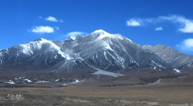
  • Shey Gompa beneath Crystal Mountain
  • Saldang, Khoma, Shimen, Tinje and Chharka cultural landscapes
  • Niwar La and Jungben La crossing toward Sangda
  • A complete west-to-east transition from Dolpo to the Kali Gandaki
  • Lo Manthang’s walled settlement and monasteries
  • A fully supported expedition far beyond Nepal’s standard lodge routes

Cost Includes

  • Domestic flights and transfers specifically listed in the confirmed quotation.
  • Licensed guide and required camping/support crew.
  • Trek permits and protected-area entries named in the final package.
  • Trek accommodation, group camping equipment and camp-kitchen service.
  • Breakfast, lunch and dinner during the trek.
  • Staff wages, meals, accommodation, insurance and field equipment.
  • Group first-aid kit, treated drinking water and basic safety equipment.
  • Applicable government taxes.
  • Agency service charges.
  • Assistance with required route and permit documentation.
  • Road travel coordination for transfers specified in the route.
  • Porter or pack-animal planning in line with the confirmed baggage arrangement.

Cost Excludes

  • International flights.
  • Nepal visa fees.
  • Personal travel, medical and rescue insurance.
  • Emergency evacuation, treatment or repatriation.
  • Personal trekking clothing and boots.
  • Personal sleeping bag and equipment unless included.
  • Drinks and personal snacks.
  • Charging, showers and personal expenses.
  • Entrance fees unless specified as included.
  • Tips for the trekking crew.
  • Extra costs caused by delay, illness, evacuation, road closure or route change.
  • Anything not specifically listed in the confirmed quotation.
  • Broken-in waterproof boots, camp shoes and trekking poles.
  • Layered base, insulation and waterproof/windproof clothing.
  • Down jacket, warm hat, gloves and thermal layers.
  • Four-season sleeping bag rated roughly –15°C to –20°C.
  • Headlamp, spare batteries, power bank and dry bags.
  • Sunglasses, SPF 50 sunscreen and lip protection.
  • Two reusable water containers and personal purification backup.
  • Personal medicines, blister care and hygiene supplies.
  • Duffel for porter transport and 30–40 litre daypack.

Day-by-Day Route Itinerary

Day 1

Fly Kathmandu to Nepalgunj

Duration: Flight about 1 hour
FromKathmandu
ToNepalgunj
Start altitude1,324 m

Begin the journey with a flight from Kathmandu to Nepalgunj, the gateway to the remote western mountain districts. As the aircraft travels west, the valley around Kathmandu gives way to hills and eventually the lower plains of Nepal. After arrival, meet the expedition team, check baggage and organize equipment for the onward flight into Dolpo. The contrasting lowland atmosphere is a noticeable change before the high-country trekking begins.

AccommodationHotel in Kathmandu
TransportFlight
Day 2

Fly to Juphal; trek to Dunai

Duration: Walk 2–3 hours

Fly from Nepalgunj toward Juphal, weather permitting, as the terrain rises into the mountain valleys of Dolpo. On arrival, begin the descent toward Dunai, following the valley paths and meeting the river landscape that shapes the first trekking stages. Small settlements and steep hillsides make this an introduction to a much quieter region of Nepal. Settle in at Dunai before entering the protected landscape farther north.

AccommodationTented camp or basic local lodge where available
MealsBreakfast, lunch and dinner
TransportFlight and trekking
Day 3

Dunai to Chhepka

Duration: Walk 6–7 hours
FromDunai
ToChhepka
End altitude2,650 m

Leave Dunai and follow the Phoksundo Khola corridor toward Chhepka, entering Shey Phoksundo National Park. The path moves through forest, river bends and small settlements, with changing views of the steep valley slopes. This lower section feels noticeably greener than the dry trans-Himalayan country farther ahead. Walking beside the river gives time to appreciate the gradual change in surroundings before the route reaches Chhepka.

MealsBreakfast, lunch and dinner
Day 4

Chhepka to Chunuwar/Rechi

Duration: Walk 6–7 hours
FromChhepka
ToChunuwar/Rechi
Start altitude2,650 m

Continue from Chhepka toward Chunuwar or the Rechi area, following the river through woodland and narrow gorge sections. The trail rises and falls as the valley becomes more enclosed and the surrounding slopes steeper. Forest shade, running water and occasional small settlements make this part of Dolpo very different from the open plateau landscapes of later days. The exact camp location follows the planned local route.

Day 5

Chunuwar to Phoksundo Lake

Duration: Walk 4–5 hours
FromChunuwar
ToPhoksundo Lake
End altitude3,600 m

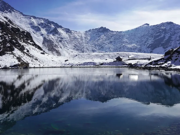
Climb from Chunuwar toward Phoksundo Lake, passing forested sections and the well-known waterfall viewpoints on the approach. The surrounding valley opens to reveal the dramatic lake basin, with steep rock walls rising above its striking blue water. Continue toward Ringmo and the lakeside area, where the scenery becomes one of the expedition’s most memorable settings. This is an excellent day to notice how abruptly the landscape changes around Phoksundo.

AccommodationTented camp or basic local lodge where available
Day 6

Acclimatization at Phoksundo

Duration: Activity 3–4 hours
FromPhoksundo
ToPhoksundo

Spend a slower day beside Phoksundo Lake, exploring Ringmo and locally accessible cultural sites where visits are permitted. The quiet lakeside setting offers time to appreciate the contrast between the deep-blue water, steep mountains and traditional village surroundings. A gentle walk may be included as part of the acclimatization plan, while the remainder of the day allows rest before the exposed trails above the lake.

AccommodationTented camp or basic local lodge where available
MealsBreakfast, lunch and dinner
Day 7

Phoksundo to Sallaghari/forest camp

Duration: Walk 6–7 hours
FromPhoksundo
ToSallaghari/forest camp

Follow the western side of Phoksundo Lake toward the Sallaghari forest camp area. The narrow trail has exposed stretches above the water, with rugged mountain walls and striking views across the lake when conditions are clear. Beyond the lakeside section, the route approaches more remote terrain with fewer permanent settlements. This day is as memorable for its dramatic setting as for the careful walking required on the narrower path.

MealsBreakfast, lunch and dinner
Day 8

Sallaghari to Kang La Base Camp

Duration: Walk 6–7 hours
FromSallaghari
ToKang La Base Camp

Leave the lakeside forest behind and climb toward Kang La Base Camp. The scenery changes from wooded slopes to rocky, open alpine terrain, and the approach begins to feel distinctly remote. High ridgelines and barren slopes surround the route as the group moves closer to the major pass. This is an important transition into the high-altitude section of Upper Dolpo, where the landscape is much more exposed.

AccommodationTented camp or basic local lodge where available
MealsBreakfast, lunch and dinner
Day 9

Cross Kang La to Shey Gompa

Duration: Walk 7–9 hours
FromCross Kang La
ToShey Gompa
End altitude4,200 m
Highest altitude5,270 m

Cross Kang La Pass and descend toward Shey Gompa, a major cultural landmark of Upper Dolpo. The high crossing offers a broad mountain setting on clear days, while the descent leads into the dry valleys around Shey. The monastery and surrounding landscape reflect the area’s long-standing religious traditions. Reaching Shey marks an important change from the Phoksundo approach to the remote highland settlements beyond the pass.

AccommodationTented camp or basic local lodge where available
MealsBreakfast, lunch and dinner
Day 10

Rest and exploration at Shey

Duration: Acclimatization or exploration walk: approximately 3–5 hours
FromShey
ToShey

Spend the day exploring Shey Gompa and its surroundings, with time for rest after the demanding pass crossing. The monastery setting beneath the remote mountain landscape reveals the spiritual importance of this part of Dolpo. A short acclimatization walk may be possible according to the local plan, allowing you to take in the open highland scenery without another long trekking stage. The afternoon provides a chance to absorb the atmosphere of Shey.

AccommodationTented camp or basic local lodge where available
MealsBreakfast, lunch and dinner
Day 11

Shey to Namgung via Shey/Gelu La

Duration: Walk 6–8 hours
FromShey
ToNamgung

Leave Shey and cross the Shey or Gelu La section on the way to Namgung. The route climbs through sparsely settled high country, where dry slopes, ridgelines and open valleys dominate the views. After the pass, descend toward the Namgung area, entering another isolated part of Upper Dolpo. The day shows the region’s distinctive trans-Himalayan terrain, far removed from the forested valleys encountered earlier in the trek.

AccommodationTented camp or basic local lodge where available
MealsBreakfast, lunch and dinner
Day 12

Namgung to Saldang

Duration: Walk 4–5 hours
FromNamgung
ToSaldang
End altitude3,920 m

Descend from Namgung toward Saldang, following dry hillsides and the valley paths between remote settlements. Saldang’s stone houses and cultivated plots stand out against the surrounding arid slopes, offering a closer look at life in Upper Dolpo. The walk is as much about observing the village landscape as covering distance. On arrival, the contrast between the settlement and its wide mountain setting becomes especially clear.

Day 13

Saldang to Khoma

Duration: Walk 5–6 hours
FromSaldang
ToKhoma
Start altitude3,920 m

Follow the route from Saldang to Khoma, crossing the high ground around Khoma La as planned. The trail moves through a landscape of dry ridges, scattered grazing land and isolated mountain settlements. Wide views across the surrounding valleys may open up in clear weather. Reaching Khoma provides another opportunity to experience Dolpo’s distinctive cultural landscape, where remote communities remain closely connected to their mountain environment.

AccommodationTented camp or basic local lodge where available
Day 14

Khoma to Shimen

Duration: Walk 6–7 hours
FromKhoma
ToShimen

Continue from Khoma toward Shimen through canyon country and a succession of high, dry valley sections. The trail reveals changing rock formations and scattered settlements that emphasize the remoteness of this part of Nepal. Unlike the greener approach to Phoksundo, the landscape here is open and windswept, with long mountain ridges visible beyond the route. The day finishes in the Shimen area.

AccommodationTented camp or basic local lodge where available
MealsBreakfast, lunch and dinner
Day 15

Shimen to Tinje

Duration: Walk 5–6 hours
FromShimen
ToTinje

Travel from Shimen toward Tinje, following the Panjyang Khola corridor through the high mountain valleys of Dolpo. The route passes open slopes and stretches of sparsely vegetated terrain, with the occasional village adding a sense of human scale to the wide landscape. Tinje is an important settlement in this remote area, offering a closer look at traditional life before the journey moves into even more isolated terrain.

MealsBreakfast, lunch and dinner
Day 16

Tinje to Yak Kharka/Mola approach

Duration: Walk 6–7 hours
FromTinje
ToYak Kharka/Mola approach

Leave the settled valley around Tinje and climb toward the Yak Kharka and Mola approach area. The route moves through higher grazing country, where open slopes and rocky mountain terrain begin to dominate the scenery. As permanent villages become fewer, the journey takes on a more expedition-like atmosphere. Broad valley views are possible in clear weather, while the day prepares the route for the demanding pass sections ahead.

AccommodationTented camp or basic local lodge where available
MealsBreakfast, lunch and dinner
Day 17

Cross Mola/Chharka La to Chharka Bhot

Duration: Walk 7–9 hours
FromCross Mola/Chharka La
ToChharka Bhot

Cross the Mola or Chharka La section and descend toward Chharka Bhot. The high ground is exposed and the terrain changes again as the route drops into a remote settlement valley. Chharka’s stone-built surroundings and Buddhist and Bön cultural influences make it a distinctive stop in Upper Dolpo. After the pass crossing, the village setting provides a memorable contrast to the open mountains above.

AccommodationTented camp or basic local lodge where available
MealsBreakfast, lunch and dinner
Day 18

Rest and contingency day at Chharka

Duration: Acclimatization or exploration walk: approximately 3–5 hours

Spend a recovery and contingency day around Chharka, an important stop before the isolated crossing toward Mustang. There is time to explore the settlement and observe its stone houses and mountain setting without another long trekking stage. The surrounding landscape is dry and rugged, and the next part of the route leads into sparsely inhabited valleys. This slower day gives the expedition space to prepare carefully for that transition.

AccommodationTented camp or basic local lodge where available
Day 19

Chharka to Norbulung

Duration: Walk 6–8 hours
FromChharka
ToNorbulung
Start altitude4,300 m

Leave Chharka and climb into the open, dry valleys leading toward Norbulung. This is a remote section with few permanent settlements, where mountain ridges and broad grazing landscapes take the place of village paths. The changing light across the high slopes can make the journey especially striking when the weather is clear. Continue to the planned camping area in preparation for the higher crossing ahead.

MealsBreakfast, lunch and dinner
Day 20

Norbulung to high camp

Duration: Walk 5–7 hours
FromNorbulung
Tohigh camp

Continue from Norbulung to the high camp beneath the Niwar La and Jungben La pass system. The route climbs through barren mountain terrain, with exposed ridges and stone-covered slopes increasingly prominent. The sense of remoteness is strong here, far from roads and established villages. Reaching the camp brings the major pass crossing closer, with broad high-altitude scenery surrounding the route.

AccommodationTented camp or basic local lodge where available
MealsBreakfast, lunch and dinner
Day 21

Cross Niwar La and Jungben La to Sangda Phedi/Ghok

Duration: Walk 8–10 hours
FromCross Niwar La and Jungben La
ToSangda Phedi/Ghok

Highest point approximately 5,550–5,560 m | Walk 8–10 hours

A long, exposed double-pass day over loose terrain. The exact camp depends on water and conditions.

of Mustang. The guide will assess weather, trail or snow conditions and the group’s health before committing to exposed terrain. Keep essential layers, water, food and sun protection accessible, follow spacing instructions, and understand that turning back or changing the route is a professional safety decision.

AccommodationTented camp or basic local lodge where available
MealsBreakfast, lunch and dinner
Day 22

Sangda Phedi/Ghok to Sangda

Duration: Walk 6–7 hours
FromSangda Phedi/Ghok
ToSangda

Continue from Sangda Phedi or Ghok toward Sangda village, crossing lower mountain terrain before descending into a more settled valley. The path remains steep in places, but the approach begins to reveal the dry ridges and cultivated pockets of Mustang. Stone-built homes and the village landscape feel especially welcoming after the remote passes. This stage marks the transition from expedition camping toward the wider Kali Gandaki corridor.

AccommodationTented camp or basic local lodge where available
MealsBreakfast, lunch and dinner
Day 23

Sangda to Phalyak

Duration: Walk 6–7 hours
FromSangda
ToPhalyak

Leave Sangda and cross the dry ridges toward Phalyak, moving closer to the Kali Gandaki valley. The landscape combines rocky slopes, distant mountain walls and settlements scattered through the high desert terrain of Mustang. As the route descends, signs of cultivated land and village life become more noticeable. The day is a gradual return from the very remote pass system to the established Mustang trail network.

MealsBreakfast, lunch and dinner
Day 24

Phalyak to Kagbeni

Duration: Walk 5–6 hours
FromPhalyak
ToKagbeni
End altitude2,804 m

Travel from Phalyak toward Kagbeni and the Kali Gandaki corridor. The open valley, stone villages and dry hillside scenery are characteristic of this part of Mustang. Kagbeni’s old lanes and mountain setting provide an appealing cultural contrast to the isolated camps farther north. The approach also brings the route near the long-used corridor connecting the lower valley with Upper Mustang.

Day 25

Drive Kagbeni to Lo Manthang

Duration: Drive 5–7 hours
FromKagbeni
ToLo Manthang
Start altitude2,804 m
End altitude3,770 m

Drive from Kagbeni north toward Lo Manthang through the permitted Upper Mustang road corridor. The scenery becomes increasingly arid, with eroded cliffs, broad valleys and traditional settlements set against the rocky hills. Although the day is primarily a road journey, there is much to observe in the changing landscape. Arriving in Lo Manthang introduces the cultural heart of the former Mustang kingdom.

TransportRoad transfer
Day 26

Explore Lo Manthang

Duration: Activity 3–5 hours

Spend the day exploring Lo Manthang, known for its walled settlement, narrow lanes and Tibetan Buddhist monasteries. The town’s traditional architecture and religious heritage provide a distinctive experience after the remote mountain traverse. Walk through accessible cultural areas and take in the surrounding high-desert scenery. The contrast between historic buildings and the vast dry landscape makes this one of Upper Mustang’s most memorable stops.

AccommodationTented camp or basic local lodge where available
MealsBreakfast, lunch and dinner
Day 27

Drive Lo Manthang to Jomsom

Duration: Drive 7–9 hours
FromLo Manthang
ToJomsom
Start altitude3,770 m
End altitude2,800 m

Leave Lo Manthang and drive south toward Jomsom through the dry valleys of Mustang. The road passes eroded hillsides and settlements along the wider Kali Gandaki region, gradually returning to a more developed travel corridor. The landscape changes as the journey leaves the upper plateau behind, although the mountains remain close. Jomsom is an important transport stop for the onward flight or road connection.

TransportRoad transfer
Day 28

Fly Jomsom to Pokhara and onward to Kathmandu

Duration: 25–30 minutes
FromJomsom
ToKathmandu
Start altitude2,800 m
End altitude822 m

Travel from Jomsom toward Pokhara and then Kathmandu using the confirmed flight arrangements. On a clear approach to Pokhara, the Kali Gandaki country gives way to greener valleys and the mountain backdrop of the Annapurna region. Weather can affect both flight sectors, so the onward connection follows the actual operating schedule. The day closes the long traverse with a striking contrast between Upper Dolpo’s remote terrain and Nepal’s busier cities.

AccommodationHotel in Kathmandu
TransportFlight

Essential Packing lists

Main Trekking Gear5
Daypack / Backpack (30–40L)Comfortable daypack with rain cover for water, layers, camera and daily essentials.
Duffel Bag (60–80L)For porter or luggage transport on multi-day trips where applicable.
Warm Sleeping BagTemperature rating should match the season and maximum sleeping altitude.
Trekking PolesUseful for long descents, uneven trails and reducing knee strain.
Water Bottles / Hydration System (2L+)Carry enough refillable capacity for the day.
Clothing – Layering System7
Moisture-Wicking Base LayersQuick-dry tops and bottoms; avoid cotton for cold/high-altitude trekking.
Fleece / Mid LayerWarm breathable layer for mornings, evenings and cooler trail sections.
Insulated Down / Synthetic JacketWarm outer insulation suitable for the season and altitude.
Waterproof / Windproof ShellLightweight hooded jacket for rain, snow and strong wind.
Trekking Pants / Hiking TrousersComfortable quick-dry trousers plus a warmer option for colder trips.
Thermal BottomsUseful for cold evenings, high camps and winter trips.
Trekking SocksSeveral pairs of moisture-wicking trekking socks plus warm socks.
Headwear & Handwear4
Sun Hat / CapFor strong daytime sun and UV exposure.
Warm BeanieWarm hat covering the ears for cold mornings and evenings.
Buff / Neck GaiterMulti-purpose protection from sun, dust, wind and cold.
Warm GlovesInsulated gloves; add waterproof outer gloves for winter/high altitude.
Footwear3
Trekking Boots (1 pair)Mostly waterproof and broken-in boots with ankle support.
Camp Shoes / Sandals (1 pair)Light footwear for lodges, camps and rest time.
GaitersRecommended for snow, mud, loose scree and winter conditions.
Toiletries & Hygiene5
Sunscreen SPF 50+High UV protection is important at altitude.
Lip Balm with SPFProtects lips from wind, cold and strong UV.
Hand Sanitizer / Biodegradable SoapCompact personal hygiene supplies.
Personal ToiletriesToothbrush, toothpaste and small personal hygiene items.
Toilet Paper / Wet WipesCarry a small personal supply and dispose responsibly.
Health & First Aid4
Personal MedicinesBring enough prescription medicine for the full trip plus reserve days.
Small Personal First-Aid KitBasic pain relief, bandages, antiseptic and common personal medicines.
Blister CareMoleskin, blister pads or similar foot-care supplies.
Water PurificationPurification tablets, drops or a reliable filter where needed.
Documents & Money4
Passport & VisaOriginal passport plus required visa documentation.
Travel Insurance DetailsCarry policy and emergency contact details; high-altitude cover when relevant.
Permit / ID CopiesKeep digital and paper copies of important travel documents.
Cash & Bank CardsRemote areas may have limited or unreliable ATM/card access.
Electronics & Accessories3
Headlamp + Spare BatteriesEssential for early starts, lodges and power cuts.
Power BankCharging can be limited or paid at remote lodges.
Phone / CameraProtect electronics from dust, rain and cold.
Optional but Recommended Items3
UV-Protected SunglassesStrong UV protection; glacier-rated lenses for snowy/high-altitude routes.
Personal Snacks / Energy BarsUseful for long walking days between meals.
Dry Bags / Zip BagsKeep electronics, documents and spare clothes dry and organized.

What Makes This Trip Different?

Two Restricted Regions

The journey combines Upper Dolpo’s high desert and monastery culture with Upper Mustang. Separate permit regimes and complex logistics make it substantially different from an ordinary circuit trek.

True Traverse

This route does not backtrack. It crosses a succession of valleys and high passes before emerging at Sangda and the Kali Gandaki, then continues to Lo Manthang by road.

Transportation Details

Transport is arranged according to the confirmed itinerary and may combine private vehicle, shared jeep and domestic flight sectors. Mountain roads, airstrips and flight schedules are sensitive to weather, visibility and operational restrictions. Timings are approximate, and travellers should keep buffer time before international departures. Any rerouting or extra costs caused by circumstances beyond the operator’s control are handled under the booking conditions.

Booking and Cancellation Information

A booking is confirmed only after Barunche accepts the reservation, issues written confirmation and receives the required deposit. The remaining balance, payment method, bank or card charges and payment deadline follow the invoice and booking terms. International travelers should use only the official company payment details shown on the invoice and keep proof of payment.

Safety, Insurance and Emergency Information

Comprehensive insurance is mandatory and must cover the route’s maximum altitude, trekking or climbing activity, medical treatment, trip interruption and helicopter evacuation in Nepal.

Permits and Entry Requirements

The final permit set is confirmed against the approved route and current Nepal government rules. Barunche arranges applicable restricted-area permits, national park or conservation-area entries and required trekking documentation through authorized channels. Restricted-area travel normally requires a licensed agency, approved guide and qualifying group arrangements. Fees and minimum-group rules are reconfirmed before a deposit is accepted.

Meals and Drinking Water

Meals are served by lodges, homestays or the field team according to the confirmed package. Menu choice becomes simpler in remote areas. Carry reusable bottles and use boiled, filtered or properly treated water.

Best Season, Weather and Temperature

Dolpo is dry compared with many Nepal trekking regions, but high camps and passes can experience freezing nights, snow, strong wind and sudden storms. Day–night temperature differences are large, and published figures are only seasonal estimates.

MOBILE NETWORK / INTERNET

Mobile coverage is absent or intermittent across much of Dolpo. Internet should not be expected outside larger access towns. Carry emergency contacts offline and understand that satellite communication may be the only option on remote expeditions when included.

US$ 4,650 PP
Save 15% US$ 850 per person
Regular:US$ 5,500
Group range:US$ 4,650 - US$ 5,500
Duration:28 Days

Group-Size Discounts

Pricing is based on your group size. We do not add others to your group.

No. of PersonsGroup TypePrice per Person
1 Pax US$ 5,500 Book
2-3 Pax US$ 5,200 Book
4-9 Pax US$ 4,850 Book
10-15 Pax US$ 4,650 Book
Dates & discounts are applied in the next step.

Guides and Porters

A licensed local guide leads the journey, manages pace and logistics, monitors weather and guest wellbeing, and coordinates accommodation, permits and transport. Porters, cooks or additional field staff are assigned according to the route, group size and confirmed package.

Translate »