Skip to content

Walk, Explore and Discover

+977 9800000000

Direct call or whatsapp 24/7

Walk, Explore and Discover

+977 9851335885

Direct call or whatsapp 24/7

Manaslu Circuit and Tsum Valley Trek – 18 Days

Key Points

DestinationNepal
Duration18 Days
Max Altitude5,160 m
MealsBreakfast, lunch and dinner (trekking days)
Group Size1-15 Pax
Best TimeMarch–May and September–November
RegionManaslu Region

Expedition Overview

The Manaslu Circuit and Tsum Valley Trek combines two distinctive journeys within the same Himalayan region. Across 18 days, travellers first explore the culturally rich Tsum Valley, then join the higher Manaslu Circuit for a mountain-pass crossing. The experience moves from forested river valleys and traditional villages to Buddhist monasteries, open alpine terrain and broad Himalayan views.

Trip Highlights

  • Explore the remote Tsum Valley
  • Experience traditional Tibetan Buddhist culture
  • Visit ancient Buddhist monasteries
  • Explore Mu Gompa
  • Visit Rachen Gompa
  • Visit Milarepa Piren Phu Cave
  • Trek through traditional Tsumba villages
  • Explore the beautiful Budhi Gandaki Valley
  • Enjoy spectacular views of Mount Manaslu
  • Visit Namrung, Samagaon and Samdo
  • Experience the traditional Himalayan lifestyle
  • Cross suspension bridges and mountain rivers
  • Walk through forests and alpine landscapes
  • Cross the famous Larkya La Pass
  • Reach an altitude of 5,106 m
  • Enjoy panoramic Himalayan mountain views

Cost Includes

  • Airport transfers.
  • Kathmandu accommodation as mentioned in the itinerary.
  • Transportation from Kathmandu to Machha Khola.
  • Transportation from Dharapani to Kathmandu.
  • Teahouse accommodation during the trek.
  • Breakfast, lunch and dinner during trekking days.
  • Experienced English-speaking trekking guide.
  • Porter service.
  • Manaslu Restricted Area Permit.
  • Tsum Valley Restricted Area Permit.
  • Manaslu Conservation Area Permit.
  • Annapurna Conservation Area Permit.
  • Guide and porter insurance.
  • Government taxes.
  • Trekking permits and necessary official documents.

Cost Excludes

  • International airfare.
  • Nepal visa fee.
  • Travel insurance.
  • Personal expenses.
  • Personal trekking equipment.
  • Hot showers and laundry.
  • Wi-Fi and charging fees.
  • Alcoholic and bottled beverages.
  • Emergency helicopter evacuation.
  • Tips for guide and porters.
  • Extra accommodation caused by delays.
  • Extra meals caused by delays.
  • Any expenses not mentioned under the included section.

Day-by-Day Route Itinerary

Day 1

Kathmandu to Machha Khola

Duration: 8–10 hours
FromKathmandu
ToMachha Khola
Start altitude1,324 m
End altitude900 m

Today, you drive from Kathmandu to Machha Khola, the starting point of your trek. The journey takes you through beautiful hills, rivers, forests and traditional villages. The road follows the Trishuli River and continues toward the Manaslu region. River crossings, steep green slopes and local villages make the lower Manaslu approach especially varied before the higher Himalayan country begins.

MealsBreakfast, lunch and dinner
TransportRoad transfer
Day 2

Machha Khola to Jagat

Duration: 6–7 hours
FromMachha Khola
ToJagat
Start altitude900 m
End altitude1,340 m

Today, you begin trekking along the Budhi Gandaki River. The trail passes through forests, waterfalls, suspension bridges and traditional villages. You gradually gain altitude as you continue toward Jagat. The Budhi Gandaki corridor is known for its deep river gorge, stone paths and villages set between steep hillsides, giving the lower trek a lively riverside atmosphere. A sequence of hillside settlements and the Budhi Gandaki valley create a varied walking landscape, from cultivated terraces to narrow gorge sections.

MealsBreakfast, lunch and dinner
Day 3

Jagat to Lokpa

Duration: 6–7 hours
FromJagat
ToLokpa
Start altitude1,340 m
End altitude2,240 m

Today, you continue through the Budhi Gandaki Valley before turning toward the Tsum Valley. The trail passes through beautiful forests and rugged mountain landscapes. After crossing the gorge, you reach Lokpa, the gateway to the Tsum Valley. The Budhi Gandaki corridor is known for its deep river gorge, stone paths and villages set between steep hillsides, giving the lower trek a lively riverside atmosphere.

Day 4

Lokpa to Chumling

Duration: 4–5 hours
FromLokpa
ToChumling
Start altitude2,240 m
End altitude2,386 m

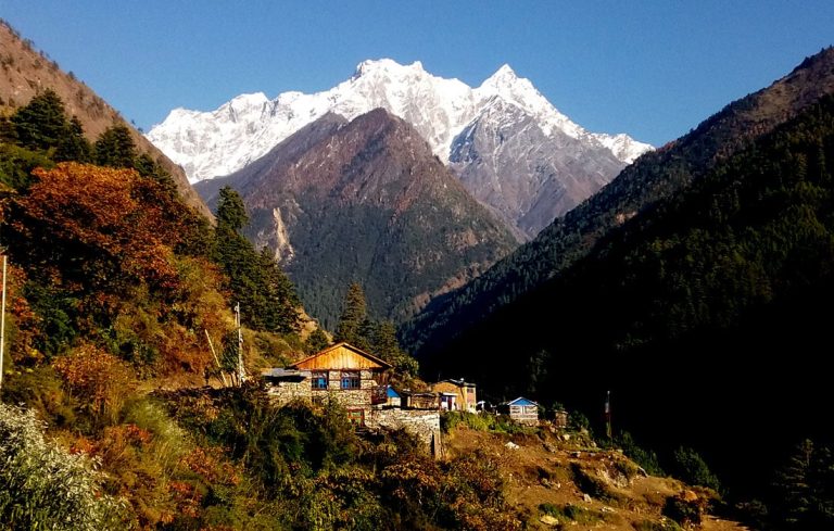
Today, you enter deeper into the Tsum Valley. The trail passes through beautiful forests and traditional villages while offering spectacular views of Ganesh Himal and surrounding peaks. Chumling is a peaceful traditional mountain village with beautiful Himalayan scenery. A sequence of hillside settlements and the Budhi Gandaki valley create a varied walking landscape, from cultivated terraces to narrow gorge sections. River crossings, steep green slopes and local villages make the lower Manaslu approach especially varied before the higher Himalayan country begins.

MealsBreakfast, lunch and dinner
Day 5

Chumling to Chokhangparo

Duration: 5–6 hours
FromChumling
ToChokhangparo
Start altitude2,386 m
End altitude3,010 m

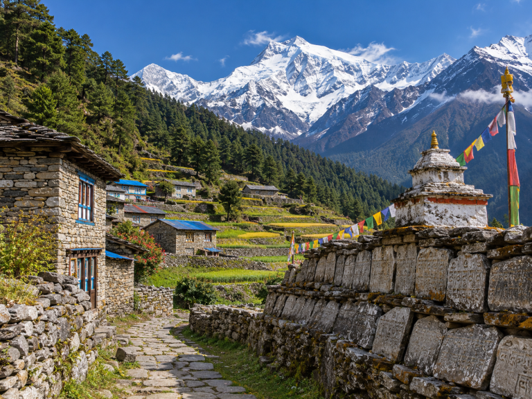
Today, you continue deeper into the Tsum Valley. The trail passes through traditional villages, Buddhist monuments, mani walls and beautiful mountain landscapes. As you gain altitude, the surrounding Himalayan scenery becomes increasingly impressive. The Budhi Gandaki corridor is known for its deep river gorge, stone paths and villages set between steep hillsides, giving the lower trek a lively riverside atmosphere.

MealsBreakfast, lunch and dinner
Day 6

Chokhangparo to Nile

Duration: 5–6 hours
FromChokhangparo
ToNile
Start altitude3,010 m
End altitude3,361 m

Today, you continue toward the upper Tsum Valley. The trail passes through traditional villages, chortens, mani walls and Buddhist cultural sites. The landscape becomes more alpine as you approach Nile. The Budhi Gandaki corridor is known for its deep river gorge, stone paths and villages set between steep hillsides, giving the lower trek a lively riverside atmosphere. A sequence of hillside settlements and the Budhi Gandaki valley create a varied walking landscape, from cultivated terraces to narrow gorge sections.

Day 7

Nile to Mu Gompa and Back to Nile

Duration: 5–6 hours
FromNile
ToNile
Start altitude3,361 m
End altitude3,361 m

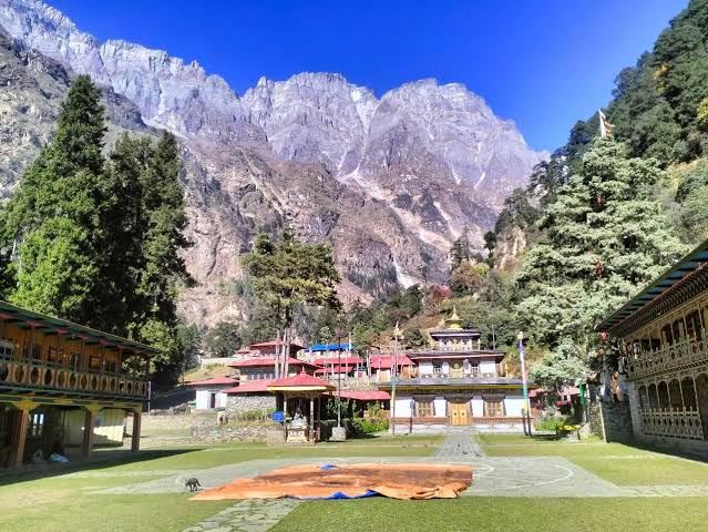
Today, you explore Mu Gompa, one of the most important monasteries in the Tsum Valley. The monastery is located in a spectacular high-altitude landscape surrounded by mountains. After exploring the monastery and surrounding area, return to Nile for the night. Mu Gompa is among Tsum Valley’s important religious sites, offering a direct experience of the region’s Tibetan Buddhist heritage. Stone houses, prayer flags and monastery traditions add cultural depth to the changing mountain scenery of the Manaslu region.

Day 8

Nile to Chumling

Duration: 6–7 hours
FromNile
ToChumling
Start altitude3,361 m
End altitude2,386 m

Today, you begin descending through the beautiful Tsum Valley. The trail passes through traditional villages, forests and Buddhist cultural sites. Enjoy the changing views of the valley as you descend toward Chumling. The Budhi Gandaki corridor is known for its deep river gorge, stone paths and villages set between steep hillsides, giving the lower trek a lively riverside atmosphere.

MealsBreakfast, lunch and dinner
Day 9

Chumling to Deng

Duration: 6–7 hours
FromChumling
ToDeng
Start altitude2,386 m
End altitude1,860 m

Today, you leave the Tsum Valley and reconnect with the main Manaslu trekking route. The trail continues through forests and along the Budhi Gandaki River. You pass through beautiful mountain landscapes before reaching Deng. The Budhi Gandaki corridor is known for its deep river gorge, stone paths and villages set between steep hillsides, giving the lower trek a lively riverside atmosphere. A sequence of hillside settlements and the Budhi Gandaki valley create a varied walking landscape, from cultivated terraces to narrow gorge sections.

MealsBreakfast, lunch and dinner
Day 10

Deng to Namrung

Duration: 6–7 hours
FromDeng
ToNamrung
Start altitude1,860 m
End altitude2,630 m

Today, you continue deeper into the Manaslu region. The trail passes through forests, traditional villages and beautiful mountain scenery. As you approach Namrung, you begin to see spectacular views of the surrounding Himalayan peaks. The Budhi Gandaki corridor is known for its deep river gorge, stone paths and villages set between steep hillsides, giving the lower trek a lively riverside atmosphere. A sequence of hillside settlements and the Budhi Gandaki valley create a varied walking landscape, from cultivated terraces to narrow gorge sections.

Day 11

Namrung to Samagaon

Duration: 6–7 hours
FromNamrung
ToSamagaon
Start altitude2,630 m
End altitude3,530 m

Today is one of the most scenic days of the trek. The trail gradually climbs toward the higher Himalayas, offering spectacular views of Mount Manaslu and surrounding peaks. You pass through beautiful mountain villages before reaching Samagaon. A sequence of hillside settlements and the Budhi Gandaki valley create a varied walking landscape, from cultivated terraces to narrow gorge sections. River crossings, steep green slopes and local villages make the lower Manaslu approach especially varied before the higher Himalayan country begins.

Day 12

Acclimatization and Exploration at Samagaon

Duration: 3–5 hours
FromSamagaon
ToSamagaon
Start altitude3,530 m
End altitude3,530 m

Today is an important acclimatization day at Samagaon. You can explore the traditional village, visit Buddhist monasteries and enjoy magnificent views of Manaslu and the surrounding mountains. The rest day allows your body to adjust to the increasing altitude before continuing toward the Larkya La Pass. The Budhi Gandaki corridor is known for its deep river gorge, stone paths and villages set between steep hillsides, giving the lower trek a lively riverside atmosphere.

MealsBreakfast, lunch and dinner
Day 13

Samagaon to Samdo

Duration: 3–4 hours
FromSamagaon
ToSamdo
Start altitude3,530 m
End altitude3,875 m

Today, you continue toward Samdo, one of the highest settlements on the Manaslu Circuit. The landscape becomes drier and more rugged as you approach the Tibetan border. Enjoy spectacular views of the surrounding mountains throughout the trek. Beyond the forested gorge, the scenery becomes more open and rugged, and the surrounding Himalayan peaks become a stronger feature on clear days.

MealsBreakfast, lunch and dinner
Day 14

Samdo to Dharamsala

Duration: 4–5 hours
FromSamdo
ToDharamsala
Start altitude3,875 m
End altitude4,460 m

Today, you trek toward Dharamsala, also known as Larkya Phedi. The trail gradually climbs through a dramatic high-altitude landscape. Dharamsala is the final overnight stop before crossing the Larkya La Pass. Higher in the Manaslu region, the valley opens toward alpine scenery, prayer-marked settlements and the snow-covered mountain backdrop visible in settled weather. The upper route has a more Himalayan character, with stone villages, open valley floors and high ridges surrounding the path.

MealsBreakfast, lunch and dinner
Day 15

Dharamsala to Larkya La Pass to Bimthang

Duration: 8–10 hours
FromDharamsala
ToBimthang
Start altitude4,460 m
End altitude3,590 m
Highest altitude5,160 m

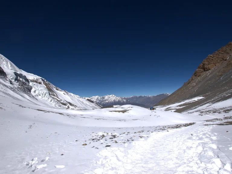
Pass – 5,106 m / 16,752 ft Bimthang – 3,590 m / 11,778 ft Today is the most challenging and rewarding day of the trek. You start early in the morning and climb toward the famous Larkya La Pass. From the top of the pass, enjoy spectacular panoramic views of Himlung Himal, Cheo Himal, Kang Guru, Annapurna II and other Himalayan peaks. After crossing the pass, you descend toward Bimthang.

MealsBreakfast, lunch and dinner
Day 16

Bimthang to Dharapani

Duration: 6–7 hours
FromBimthang
ToDharapani
Start altitude3,590 m
End altitude1,860 m

Today, you continue descending through beautiful forests and mountain landscapes. The trail passes through several villages before reaching Dharapani. Dharapani is located in the Marsyangdi Valley and connects with the Annapurna trekking region. River crossings, steep green slopes and local villages make the lower Manaslu approach especially varied before the higher Himalayan country begins.

MealsBreakfast, lunch and dinner
Day 17

Dharapani to Besisahar and Kathmandu

Duration: 8–10 hours
FromDharapani
Start altitude1,860 m

Today, you leave Dharapani and drive toward Besisahar. After reaching Besisahar, continue by road toward Kathmandu. The journey takes you through beautiful hills, rivers, villages and countryside. The Budhi Gandaki corridor is known for its deep river gorge, stone paths and villages set between steep hillsides, giving the lower trek a lively riverside atmosphere.

MealsBreakfast, lunch and dinner
TransportRoad transfer
Day 18

Departure from Kathmandu

Duration: 30–60 minutes
FromKathmandu
Start altitude1,324 m

Today is the final day of your Manaslu Circuit and Tsum Valley Trek. Our team will arrange your transfer to Tribhuvan International Airport according to your international flight schedule. We hope you enjoyed your Himalayan adventure and look forward to welcoming you again for another journey in Nepal. fixed-time transfer. Weather, road or flight conditions may affect the arrival schedule, so an international departure should not be booked too tightly. The guide assists with the confirmed transport and checks that personal equipment and baggage are accounted for.

Essential Packing lists

Main Trekking Gear5
Daypack / Backpack (30–40L)Comfortable daypack with rain cover for water, layers, camera and daily essentials.
Duffel Bag (60–80L)For porter or luggage transport on multi-day trips where applicable.
Warm Sleeping BagTemperature rating should match the season and maximum sleeping altitude.
Trekking PolesUseful for long descents, uneven trails and reducing knee strain.
Water Bottles / Hydration System (2L+)Carry enough refillable capacity for the day.
Clothing – Layering System7
Moisture-Wicking Base LayersQuick-dry tops and bottoms; avoid cotton for cold/high-altitude trekking.
Fleece / Mid LayerWarm breathable layer for mornings, evenings and cooler trail sections.
Insulated Down / Synthetic JacketWarm outer insulation suitable for the season and altitude.
Waterproof / Windproof ShellLightweight hooded jacket for rain, snow and strong wind.
Trekking Pants / Hiking TrousersComfortable quick-dry trousers plus a warmer option for colder trips.
Thermal BottomsUseful for cold evenings, high camps and winter trips.
Trekking SocksSeveral pairs of moisture-wicking trekking socks plus warm socks.
Headwear & Handwear4
Sun Hat / CapFor strong daytime sun and UV exposure.
Warm BeanieWarm hat covering the ears for cold mornings and evenings.
Buff / Neck GaiterMulti-purpose protection from sun, dust, wind and cold.
Warm GlovesInsulated gloves; add waterproof outer gloves for winter/high altitude.
Footwear3
Trekking Boots (1 pair)Mostly waterproof and broken-in boots with ankle support.
Camp Shoes / Sandals (1 pair)Light footwear for lodges, camps and rest time.
GaitersRecommended for snow, mud, loose scree and winter conditions.
Toiletries & Hygiene5
Sunscreen SPF 50+High UV protection is important at altitude.
Lip Balm with SPFProtects lips from wind, cold and strong UV.
Hand Sanitizer / Biodegradable SoapCompact personal hygiene supplies.
Personal ToiletriesToothbrush, toothpaste and small personal hygiene items.
Toilet Paper / Wet WipesCarry a small personal supply and dispose responsibly.
Health & First Aid4
Personal MedicinesBring enough prescription medicine for the full trip plus reserve days.
Small Personal First-Aid KitBasic pain relief, bandages, antiseptic and common personal medicines.
Blister CareMoleskin, blister pads or similar foot-care supplies.
Water PurificationPurification tablets, drops or a reliable filter where needed.
Documents & Money4
Passport & VisaOriginal passport plus required visa documentation.
Travel Insurance DetailsCarry policy and emergency contact details; high-altitude cover when relevant.
Permit / ID CopiesKeep digital and paper copies of important travel documents.
Cash & Bank CardsRemote areas may have limited or unreliable ATM/card access.
Electronics & Accessories3
Headlamp + Spare BatteriesEssential for early starts, lodges and power cuts.
Power BankCharging can be limited or paid at remote lodges.
Phone / CameraProtect electronics from dust, rain and cold.
Optional but Recommended Items3
UV-Protected SunglassesStrong UV protection; glacier-rated lenses for snowy/high-altitude routes.
Personal Snacks / Energy BarsUseful for long walking days between meals.
Dry Bags / Zip BagsKeep electronics, documents and spare clothes dry and organized.

What Makes This Trip Different?

Authentic Culture / Local Experience Combine sacred Tsum monasteries with the Nubri settlements of the upper Manaslu valley. Nature / Adventure / Responsible Travel The route links a secluded cultural valley with the glaciated Larkya La crossing, using local services and guided low-impact travel. Trip Information Region: Tsum Valley and Manaslu Circuit Duration: 18 days Maximum altitude: Larkya La – approximately 5,106 m / 16,752 ft

Accommodation Details

Trekking Style: Teahouse Trek Starting Point: Machha Khola Ending Point: Dharapani Highest Point: Larkya La Pass – 5,106 m / 16,752 ft

Transportation Details

Long road transfers serve Machha Khola and the Dharapani/Besisahar exit. Exact times remain road dependent. Permits Restricted-area permits for Tsum and Manaslu, Manaslu Conservation Area Permit and Annapurna Conservation Area Permit are normally required. Guide & Porter Information A licensed guide is required where restricted-area rules apply and manages permits, pacing,

Connectivity and Trail Facilities

Charging and Wi-Fi may be available for a fee in larger villages but are limited or absent at remote lodges and camps. Carry power banks and offline documents. Mobile Network / Internet Coverage is intermittent and may disappear for several days. Family should not expect daily contact. Toilets & Showers Most lodges use basic shared toilets. Hot showers become limited at altitude; conserve water and pack out non-biodegradable hygiene waste.

Safety, Insurance and Emergency Information

Day 12: Acclimatization and Exploration at Samagaon Elevation: Samagaon – approximately 3,530 m / 11,581 ft Approximate time: Acclimatization or exploration walk: approximately 3–5 hours Meals: Breakfast, lunch and dinner Today is an important acclimatization day at Samagaon. You can explore the traditional village, visit Buddhist monasteries and enjoy magnificent views of Manaslu and the surrounding mountains. The rest day allows your body to adjust to the increasing altitude before continuing toward the Larkya La Pass. Overnight: Samagaon What to expect: This is an active adjustment day rather than complete inactivity. A gentle walk or locally appropriate excursion supports acclimatization while introducing the Budhi Gandaki and upper Manaslu valleys, where Tibetan-influenced villages and increasingly alpine terrain define the trail. The guide controls the height gain and return time, leaving the afternoon for hydration, equipment checks and recovery. Any headache, nausea, unusual fatigue, poor sleep or breathlessness should be reported early so the following stage can be assessed conservatively. Day 13: Samagaon to Samdo Meals: Breakfast, lunch and dinner Samdo – 3,875 m / 12,713 ft Today, you continue toward Samdo, one of the highest settlements on the Manaslu Circuit. The landscape becomes drier and more rugged as you approach the Tibetan border. Enjoy spectacular views of the surrounding mountains throughout the trek. Trekking Time: Approximately 3–4 hours Overnight: Samdo

Permits and Entry Requirements

Restricted-area permits for Tsum and Manaslu, Manaslu Conservation Area Permit and Annapurna Conservation Area Permit are normally required. Guide & Porter Information A licensed guide is required where restricted-area rules apply and manages permits, pacing,

Best Season, Weather and Temperature

agricultural areas, ask before photographing people, and allow local residents and pack animals priority. Arrival time remains approximate and use the afternoon to eat, hydrate and recover. Day 17: Dharapani to Besisahar and Kathmandu Elevation: Kathmandu – approximately 1,400 m / 4,593 ft Meals: Breakfast, lunch and dinner Today, you leave Dharapani and drive toward Besisahar. After reaching Besisahar, continue by road toward Kathmandu. The journey takes you through beautiful hills, rivers, villages and countryside. Driving Time: Approximately 8–10 hours Overnight: Kathmandu What to expect: The stage from DHARAPANI TO BESISAHAR AND KATHMANDU reveals gradual changes in landscape and settlement, making the journey more than a simple transfer between overnight stops. Within the Budhi Gandaki and upper Manaslu valleys, where Tibetan-influenced villages and increasingly alpine terrain define the trail, trail surfaces, bridge conditions and seasonal water levels can alter the pace. Keep rain protection, sun protection and drinking water accessible. The guide will manage breaks and may modify the stopping point if weather or trail conditions, accommodation availability, or a participant’s health make the published schedule impractical. Day 18: Departure from Kathmandu Elevation: Kathmandu – approximately 1,400 m / 4,593 ft Approximate time: Airport transfer: approximately 30–60 minutes

US$ 1,550 PP
Save 30% US$ 650 per person
Regular:US$ 2,200
Group range:US$ 1,550 - US$ 2,200
Duration:18 Days

Group-Size Discounts

Pricing is based on your group size. We do not add others to your group.

No. of PersonsGroup TypePrice per Person
1 Pax US$ 2,200 Book
2-3 Pax US$ 1,900 Book
4-9 Pax US$ 1,700 Book
10-15 Pax US$ 1,550 Book
Dates & discounts are applied in the next step.

Guides and Porters

An experienced trekking guide accompanies the group, coordinates route decisions and accommodation, and monitors the day’s conditions and group wellbeing. Travelers should follow the guide’s instructions at exposed trails, river crossings and high-altitude sections. Porter support is arranged as specified in the included package services and baggage allowance.

Translate »